discover more discover more discover more discover more discover more discover more discover more discover more discover more discover more discover more discover more
Great Snowy River Country Walks
Trails & Highlights
- Raymond Creek Falls
- Little River Gorge & Waterfalls Walk
- Tulloch Ard Gorge Lookout Walk
- Spring Creek & Moon Hill Walks
- Basin Creek Falls
- Grandview Lookout
- Cape Conran Nature Trail
- Cabbage Tree Palms Walk
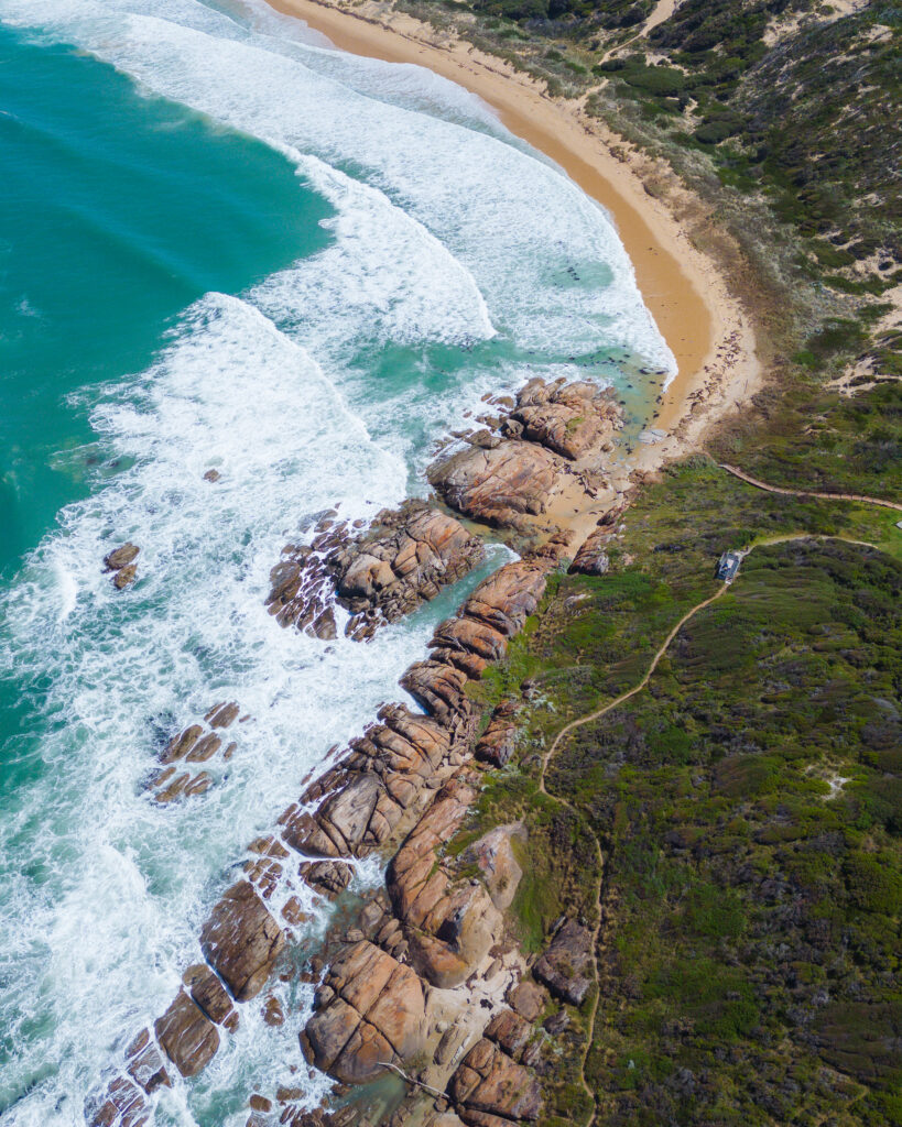
- Mots Beach & the mouth of the Snowy River
- Errinundra Saddle Rainforest Walk
- Orbost Slab Hut & Snowy River Walk
Great Snowy River Country Walks
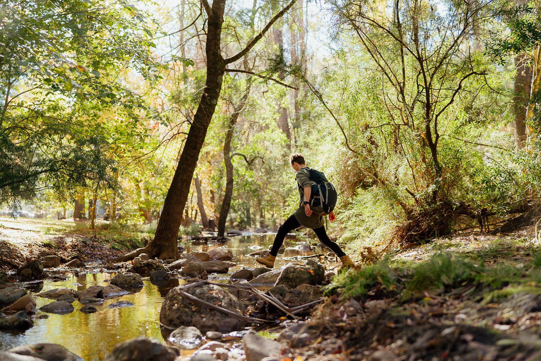
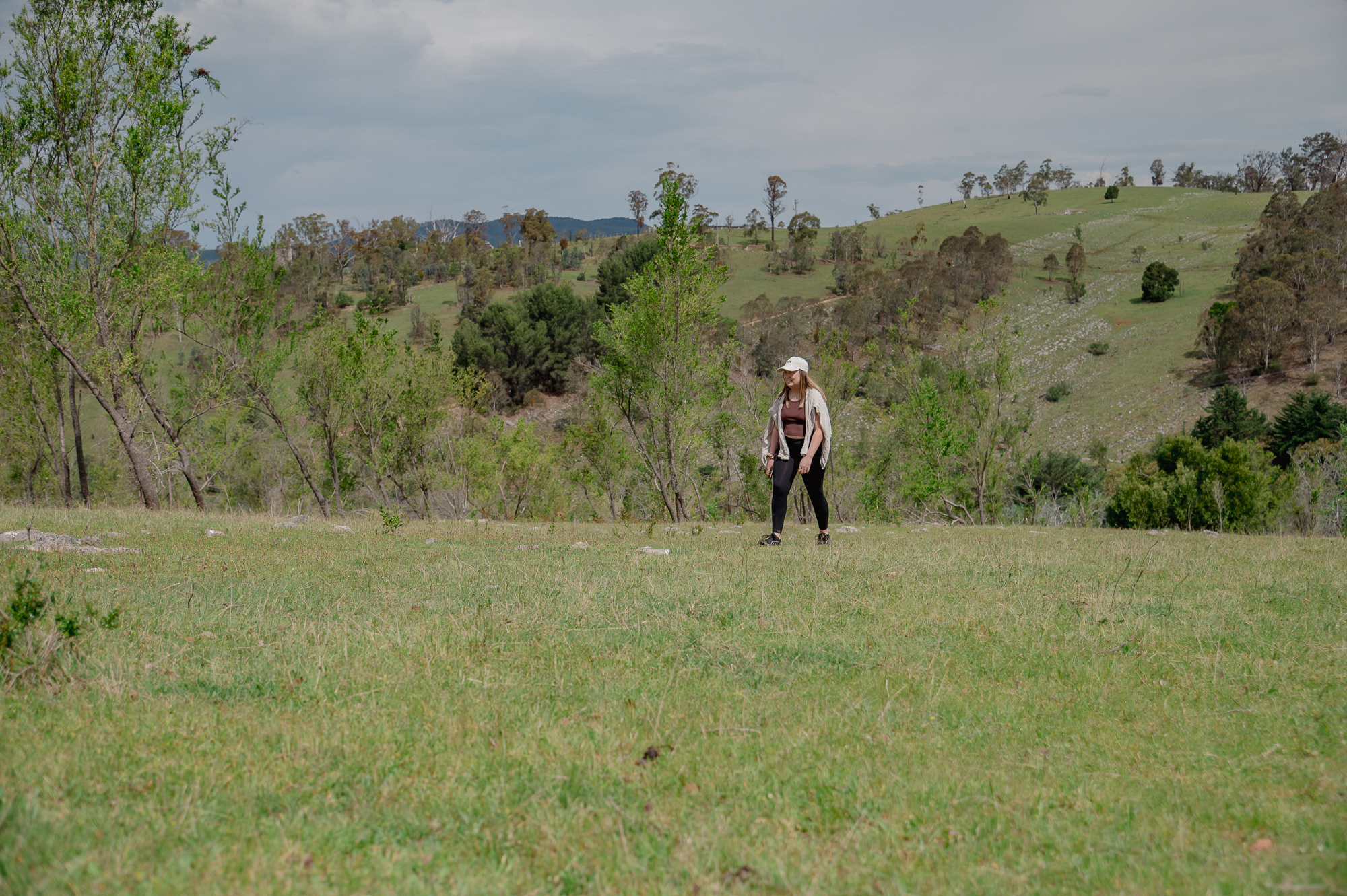
Experience some of East Gippsland’s finest walking trails as you explore routes connecting scenic highlights of Orbost, Buchan, Marlo, Errinundra, and Cape Conran. Not only is this region a nature lover’s dream, but it also offers spectacular walking experiences through ancient forests, dramatic river valleys, and pristine coastlines, all within a short drive of charming country towns and stunning national parks. Whether embarking on a scenic stroll to Raymond Creek Falls near Orbost, strolling the scenic bushland tracks of Buchan Caves Reserve, soaking up ocean views of Marlo and Cape Conran’s beaches, or immersing yourself in the rainforest magic of Errinundra, each walk brings a new perspective on East Gippsland’s diverse landscape.
Additionally, these trails showcase unique wildlife and tell fascinating stories—perfect for bushwalking, birdwatching, picnicking, and family day trips. Since many routes feature boardwalks, lookouts, and picnic areas, as well as easy access from key towns, every visitor can find an outing tailored to their interests and abilities. In summary, plan your next adventure to explore top walks, discover secret gems, and enjoy the must-do activities that make the Snowy River Country of East Gippsland such an unforgettable destination.
Ready to walk? Always prepare: visit our Plan Your Visit pages for key safety tips and emergency alert resources, and be sure to check the Parks Victoria website for up-to-date park advice before you explore.
30 minutes one way
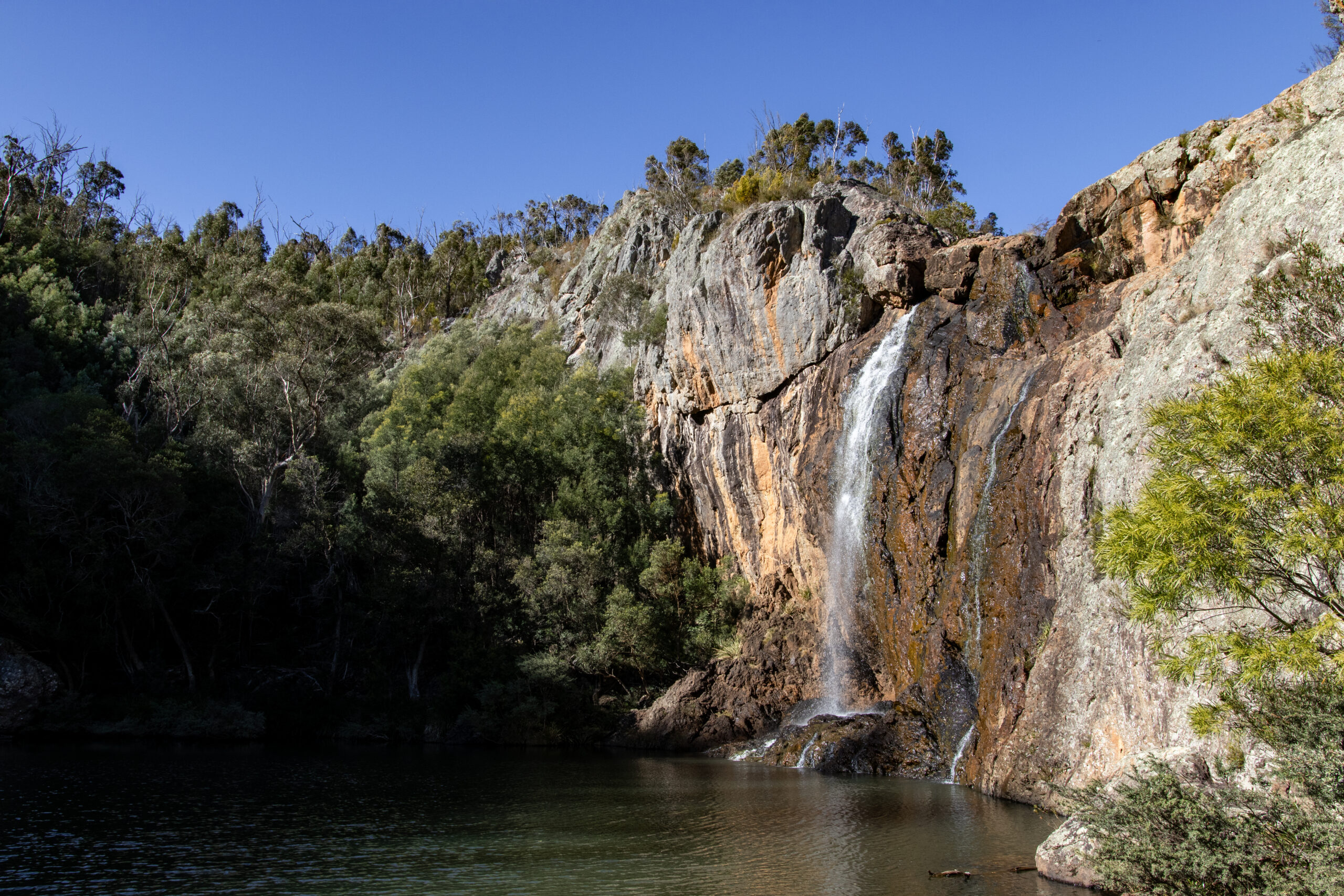
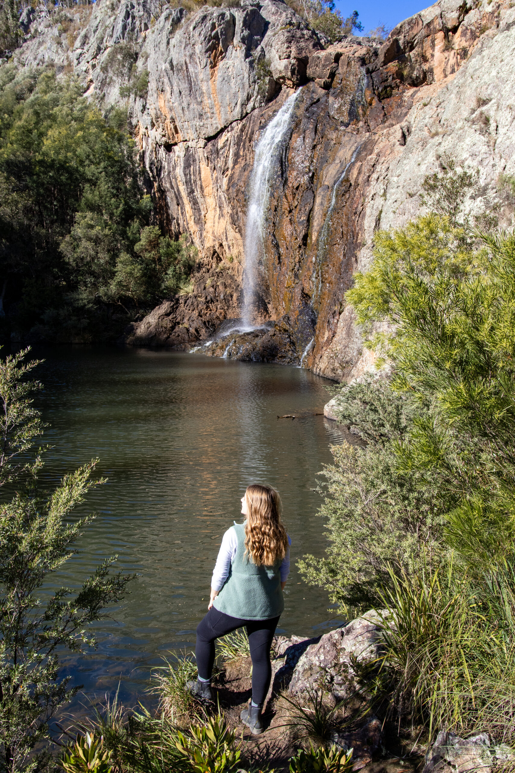
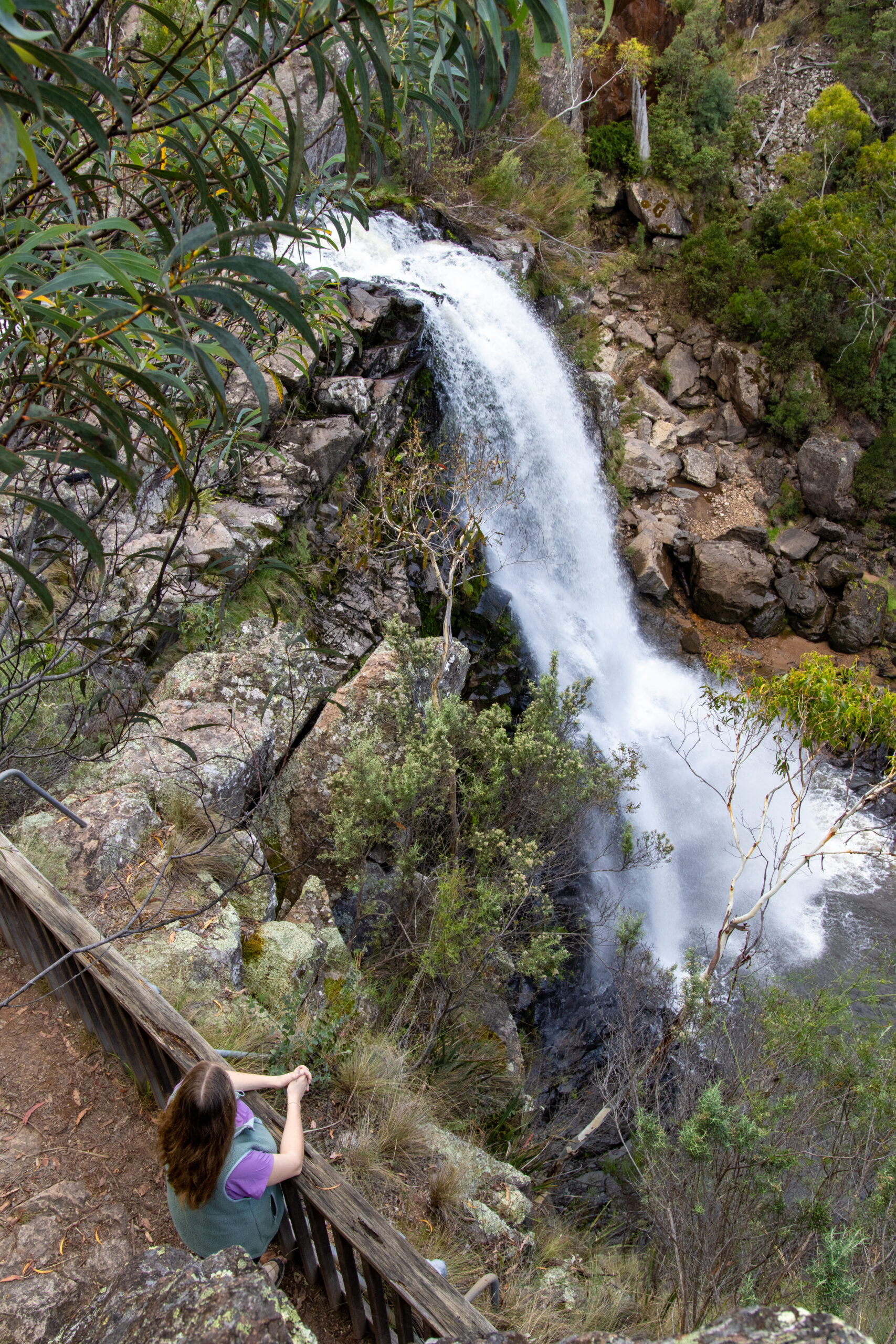
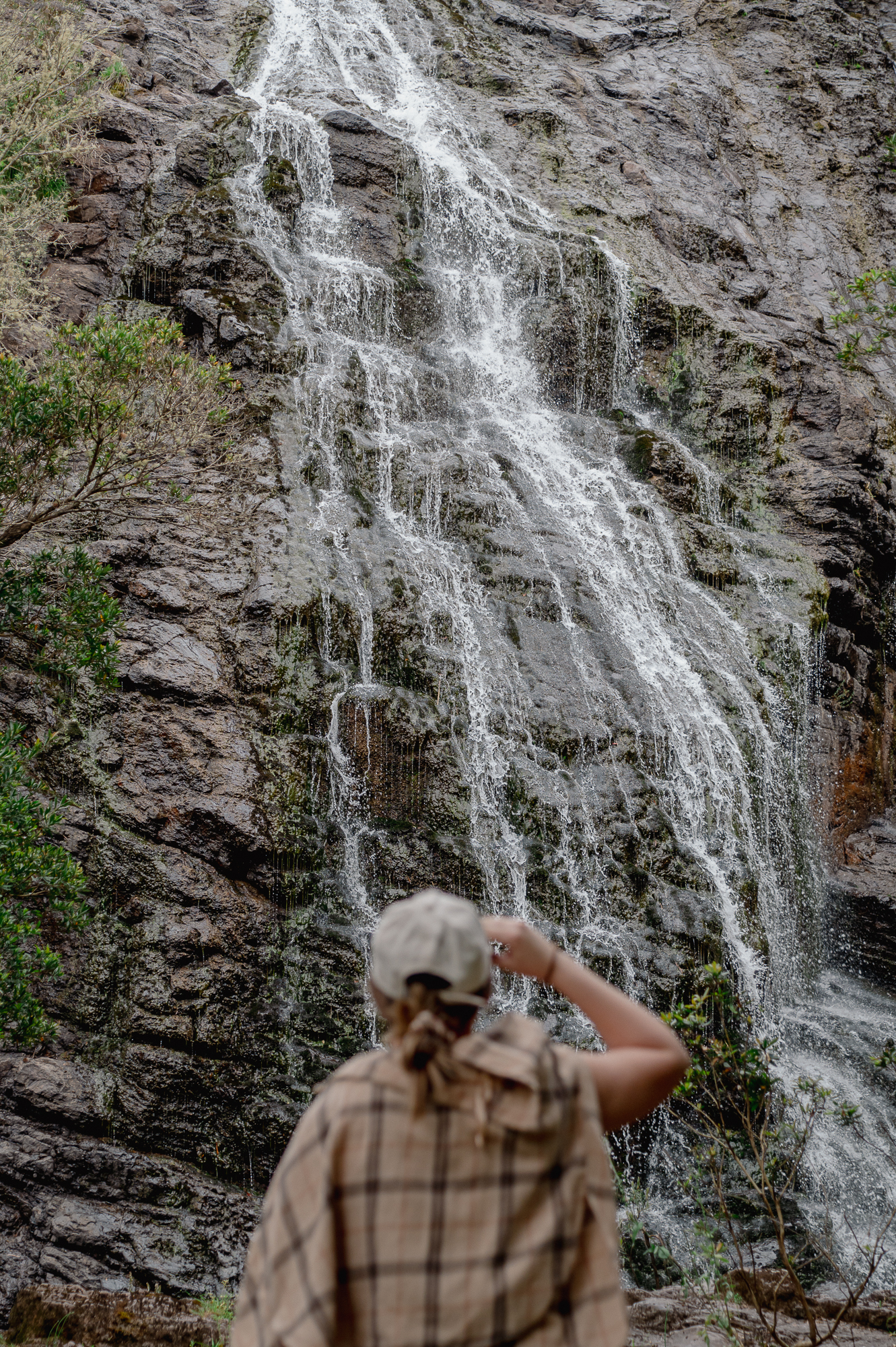
Raymond Creek Falls Walk
Snowy River National Park. Grade 2-3. 1km. (30 mins one way). Distance from Orbost approx 70kms.
The drive to this walk is worth the trip alone, as a day trip into the Snowy River National Park. The walk itself leads to spectacular views of the 20m plunge of the Raymond Creek Falls to a deep, clear pool. To get another perspective, continue further 300m to the bottom of the falls. Picnic and fireplace facilities are set within natural openings within the bush.
Getting there:
These picturesque falls in the south of Snowy River National Park can be reached year-round from Orbost along Moorsford Road. The route is a scenic drive with some gravel sections and is suitable for most vehicles under normal conditions.
30 minutes return
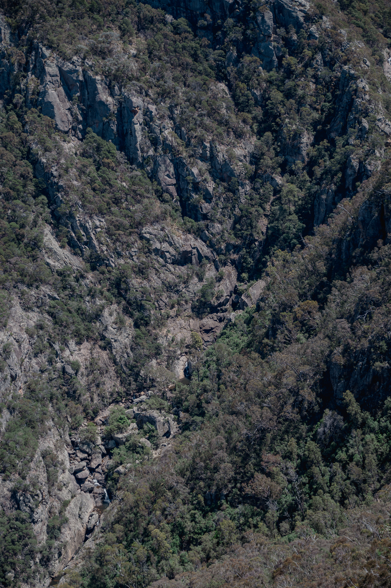
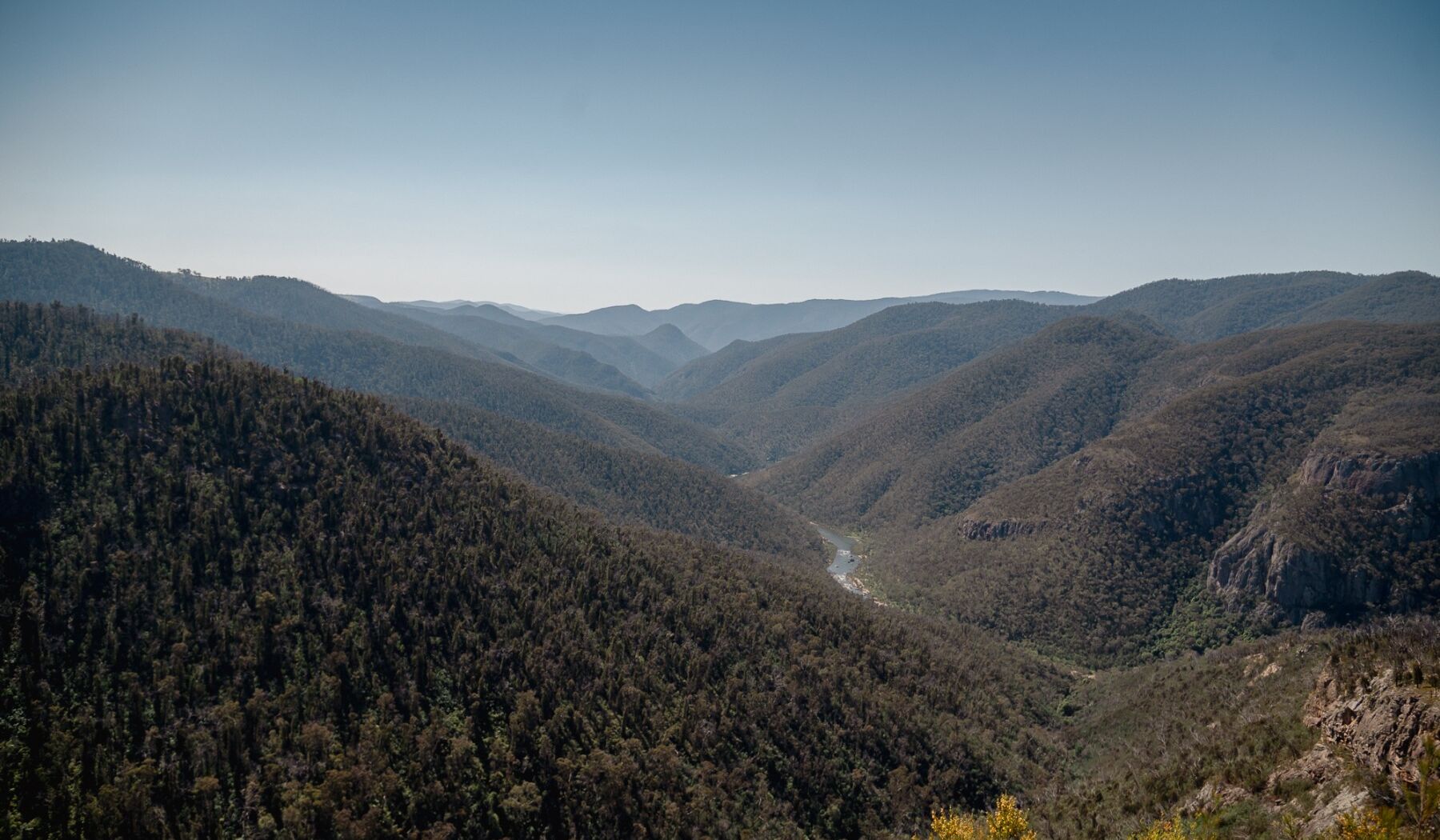
Little River Gorge and Waterfalls Walk
Snowy River National Park. Gorge Lookout Walk: Grade 3, short but steep path. 800m return (30 mins). Waterfalls walk: Grade 3. 400m return (15 mins) Distance from Buchan approx 67km.
The Little River Gorge walk in Snowy River National Park features a short, well-formed trail leading to lookout platforms with spectacular views over Victoria’s deepest gorge and the dramatic Little River Falls cascading into the rugged valley below. The trail showcases sheer cliffs, lush forest, and a tranquil atmosphere ideal for photography and wildlife spotting. This walk is a must-see East Gippsland experience where the wild river plunges into one of the region’s most striking natural landscapes.
Getting there:
To reach Little River Gorge and Little River Falls from Buchan, take Gelantipy Road north, then continue onto McKillops Road, following the signs to each site. The last sections are unsealed, narrow and winding—allow about 1 hour for the 64km journey to the falls, with the gorge a few minutes further along.
1.5 hours return
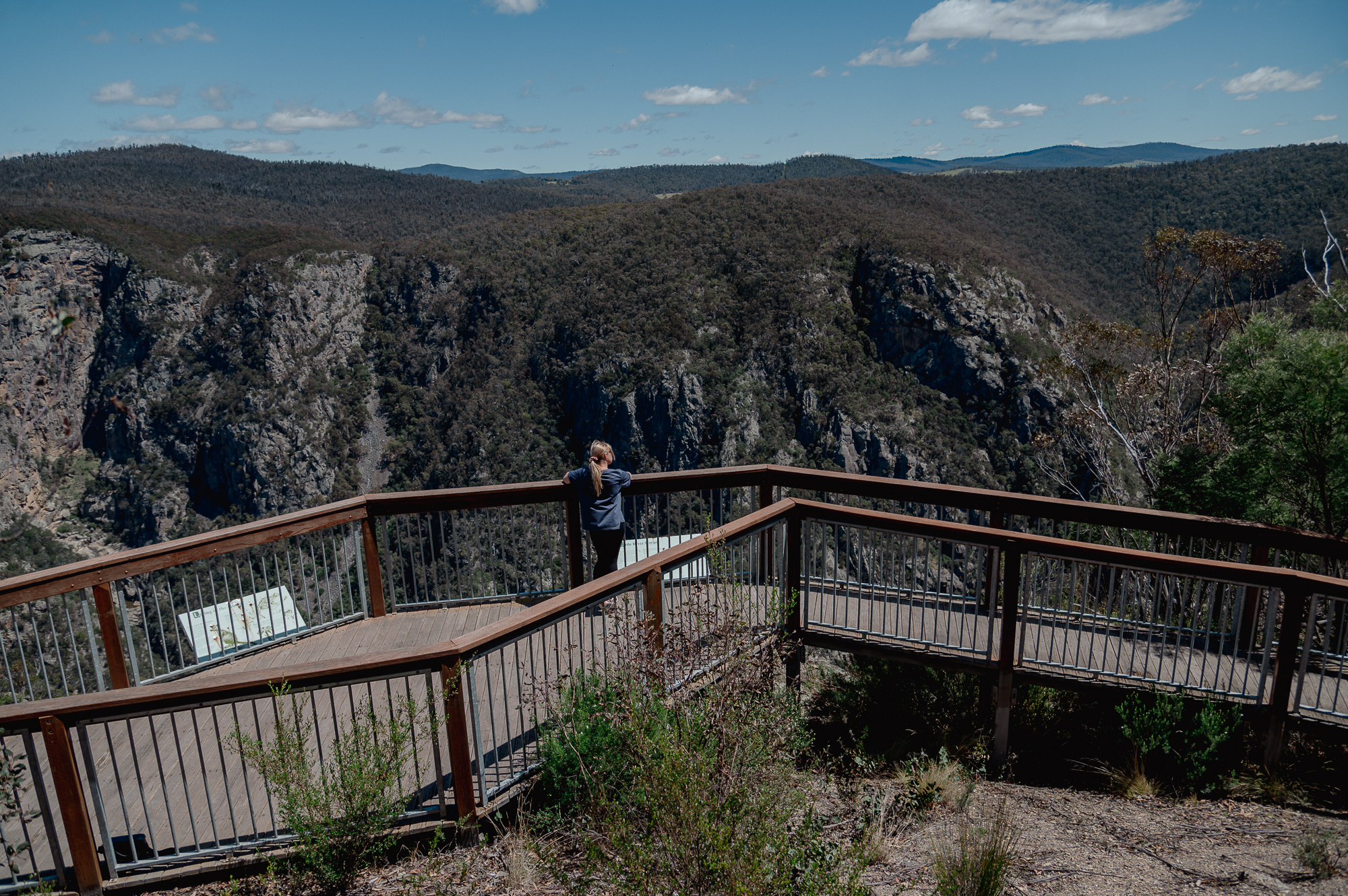
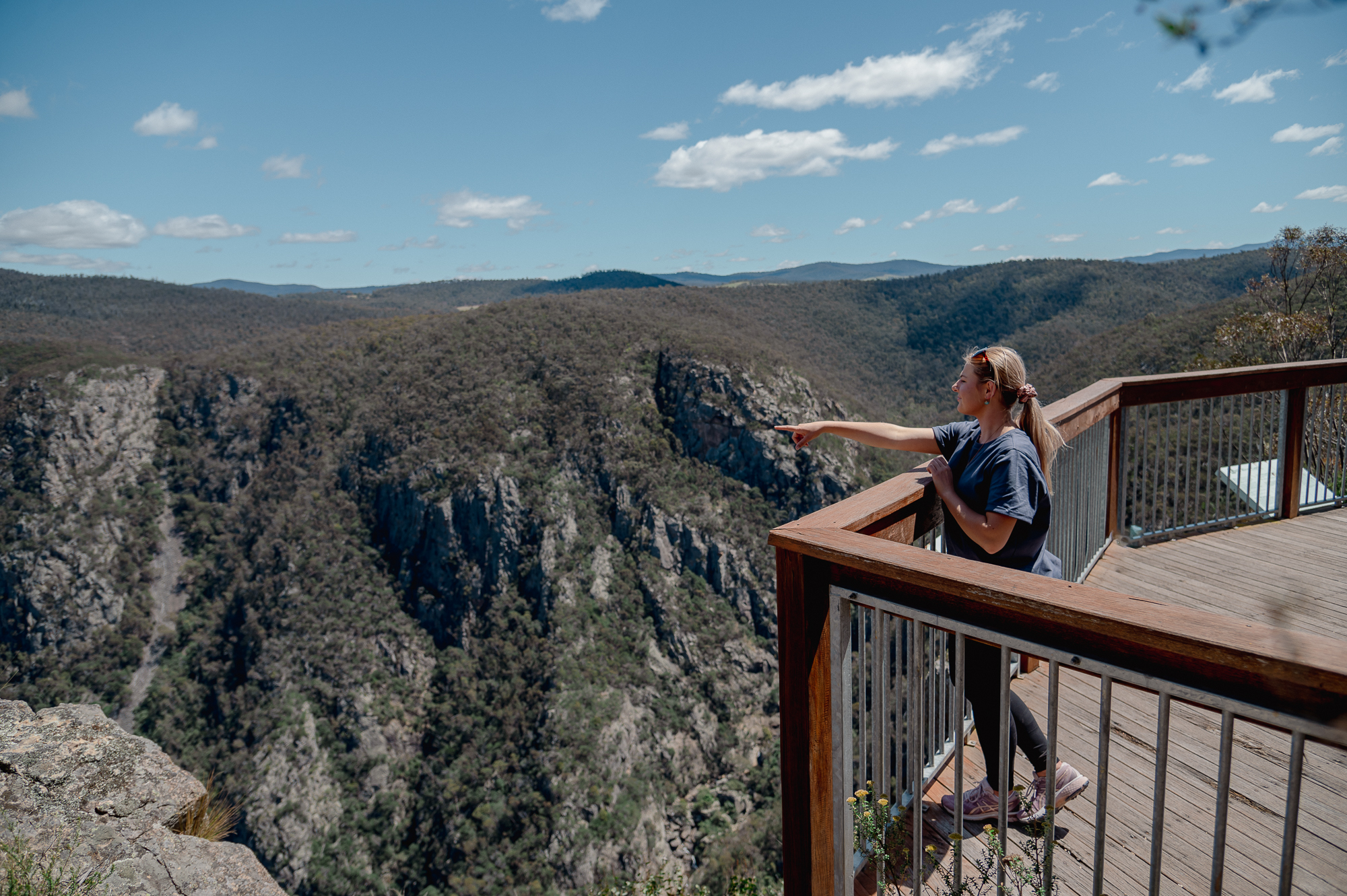
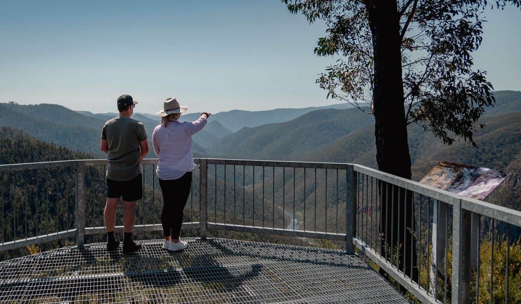
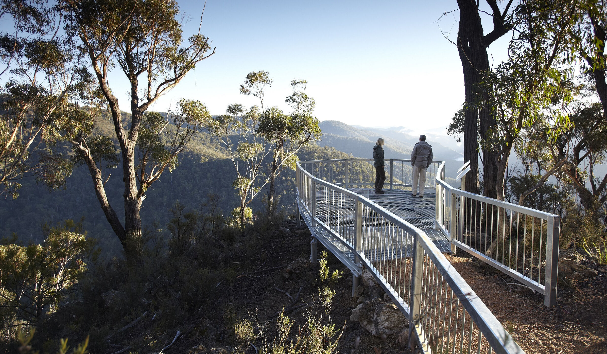
Tulloch Ard Lookout Walk
Snowy River National Park. Grade 3. 3.2km return (1 hour 30 mins). Distance from Buchan approx 41km.
Discover the natural beauty of Snowy River National Park on the Tulloch Ard Lookout Walk—a moderate bushwalk perfect for both keen hikers and adventurous day-trippers. This 3.2 km return track (Grade 3) winds through Mountain Grey Gum forest, descends through diverse vegetation, and rewards walkers with sweeping views over the wild Snowy River and rugged Tulloch Ard Gorge. Expect to spend about 1 hour and 30 minutes on the return journey, allowing time to soak in the scenery and spot local wildlife.
The trailhead is located about 41.2 km (roughly 45 minutes’ drive) north of Buchan, making it an accessible nature escape from town. The walk begins and ends at the Tulloch Ard car park, a small roadside area just inside the national park boundaries. Be aware that some sections are steep and there are steps, so a moderate level of fitness and bushwalking experience is recommended.
Getting there:
From Buchan, follow Gelantipy Road north for approximately 41.2 km until you see the signposted turn-off to Tulloch Ard Road (gravel). Turn right and continue for 12 km as the road enters Snowy River National Park, then left onto Fork Track for the final kilometer to the Tulloch Ard car park. Conventional two-wheel drive vehicles can manage the drive in dry weather, but always check road conditions before departure, bring supplies as there are no shops or fuel on route, and allow around 2.5 hours for the total round trip including driving and the walk itself.
30 minutes
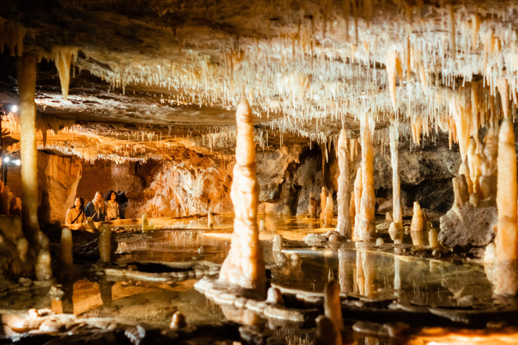
Moon Hill Walk
Buchan Caves Reserve. Grade 1. Moon Hill: 0.5km (0.5hrs return)
This short walks leads to an excellent viewing spot over the Reserve. You’ll pass Moon Cave – so take your torch to peak in the entrance. See a large collapsed cave at Devils Punchbowl. Return to the Reserve via North Arm, or veer to the right to follow the ridge for views out over the Buchan Township.
1.5 hours
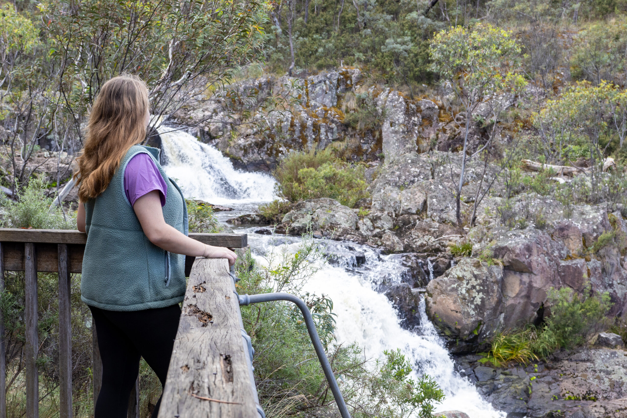
Spring Creek Walk
Buchan Caves Reserve. Spring Creek: 3km (1.5hrs return) Grade 2.
This walk splits into the higher Tea-Tree Track and the lower Kanooka Track; both meeting at the Spring Creek Falls. Tea-Tree Track is adventurous with some steep areas. A short distance along the track, to your left, the rock type changes from the Buchan Caves limestone to the older Snowy River volcanics.
Enjoy the fall from a viewing platform at the end of the track. On the return walk, take the lower Kanooka track and criss cross the remnants of Riparian Rainforest – a combination of moss covered rocks and fern trees dominated by Kanooka. Watch for Lyrebird scratchings and the Gippsland Water Dragons.
1 hour
Basin Creek Falls Walk
Snowy River National Park. Grade 3 to 4. 2.6km return (1 hour). Distance from Buchan approx 13.3km (20 minutes). Distance from Orbost 64km (1hr 10 minutes)
Basin Creek Falls is a hidden gem of Snowy River National Park, accessed by a moderate bushwalk winding through dry open forest and along creeklines alive with birdlife. The walk ends at a scenic amphitheatre where water tumbles over basalt rock into a tranquil plunge pool—a perfect spot for a rest or nature photography session. Expect rocky sections underfoot, and bring sturdy shoes and water for this peaceful adventure away from crowds.
20 minutes
Grandview Lookout Walk
Grade 1. 600m return (20 mins). Distance from Orbost approx 5km.
Grandview Lookout, near Newmerella, provides panoramic views over Orbost, the Snowy River floodplains, the historic rail bridge, and the eastern reaches of the iconic East Gippsland Rail Trail. The easy walk from the carpark climbs gently to a viewing area with interpretive signage, making this a rewarding spot for sunset photography, local history, and sweeping panoramas of the countryside. Walkers and cyclists on the East Gippsland Rail Trail often use this lookout as a scenic stop or a vantage point to observe the length of the railway corridor as it meets the floodplain.
Getting there:
From Orbost, head south-west along Princes Highway towards Newmerella, then follow signs to Grandview Lookout—just minutes by car from town and close to the trailhead of the East Gippsland Rail Trail. Ample parking is available near the start of the walk.
2 hours
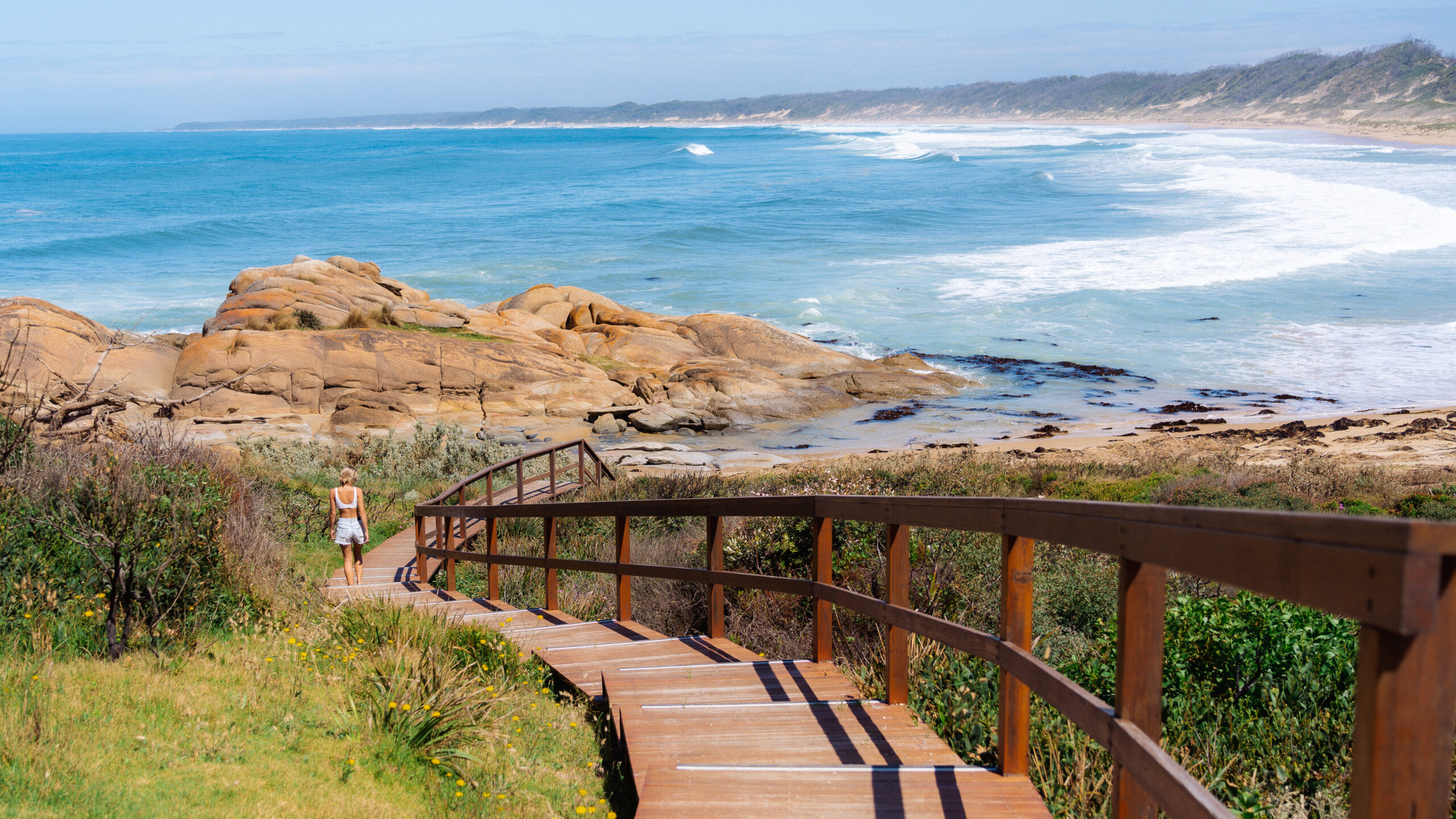
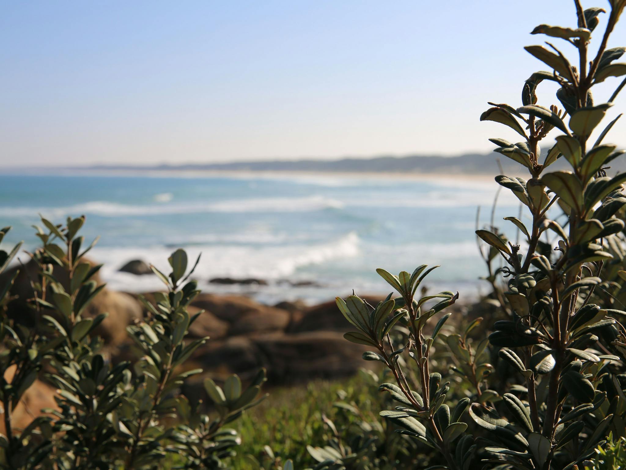
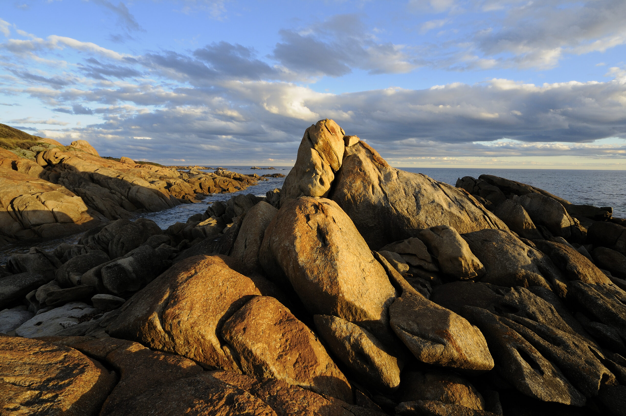
Cape Conran Nature Trail
Cape Conran Coastal Park. Grade 1 – 2. Trail length is 3km (2 hours return) Cape Conran Nature Trail is 18kms from Marlo.
Follow the trail to the top of the headland, where you can take in excellent views towards Point Hicks and Mt Everard to the east, Mt Bemm to the northeast and Mt Raymond to the northwest. Outstanding ocean views, plentiful wildlife, coastal heathland and excellent diving and fishing make this scenic cape a popular haven for both nature lovers and holidaymakers.

30 minutes
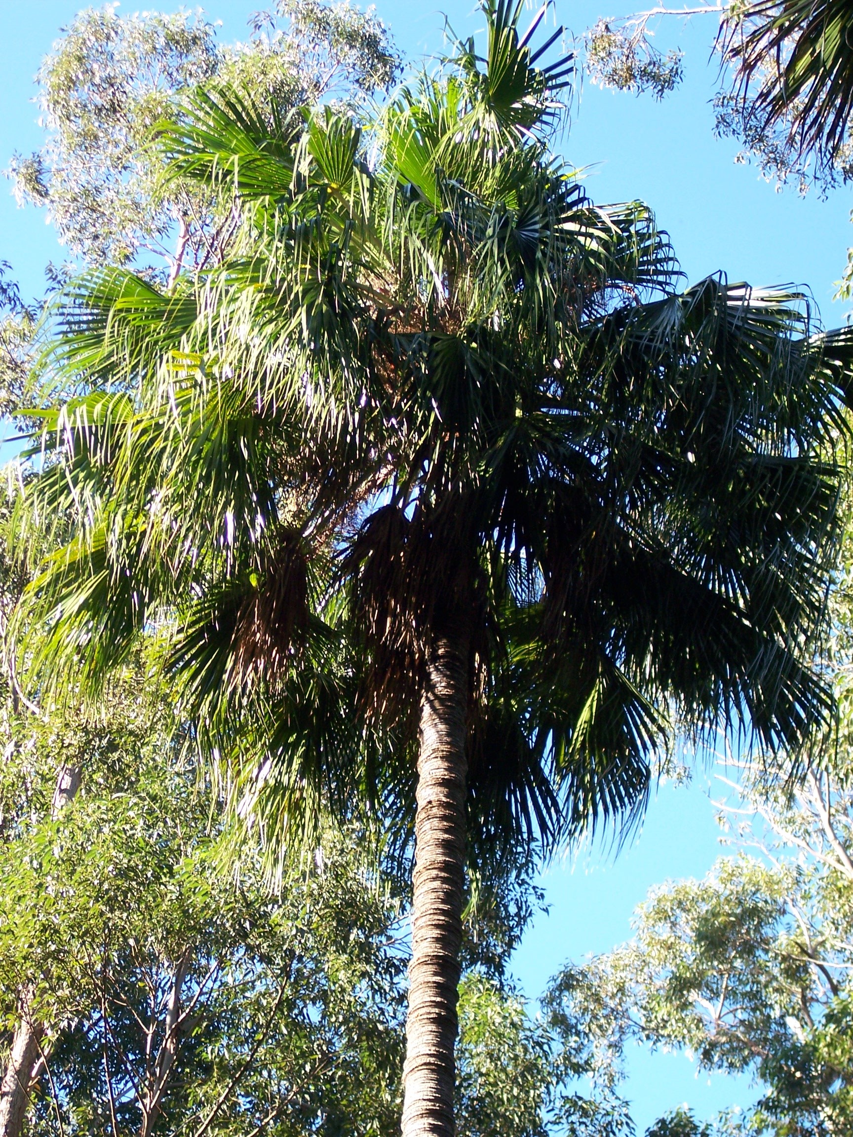
Cabbage Tree Palms Walk
Grade 1. 1km, 30 minutes return. Distance from Marlo approx 16.6 kms (21 minutes) via Marlo-Conran Road and Marlo-Cabbage Tree Road.
This tranquil walk features the southern most stand of Cabbage Fan Palms – usually found further north along the Australian coastline. There are only a few hundred specimens growing in this very restricted area, scattered amongst the Mahogany Gum forests and nestled along the Cabbage Tree Creek. The walk follows a rambling track into the palms, with Bell Miners providing an orchestral ambience. The Rosellas are a birdwatchers delight! If you’re lucky, you might hear the mimicking calls of a superb male lyrebird engaging in his courtship serenade. Stay a little longer in this spot to enjoy a picnic and bask in the peaceful tranquillity.
How to get there:
Follow the signs from Marlo in the direction of Cape Conran. Watch for the signed turn off to Cabbage Tree Palms. Alternatively, if travelling between Orbost and Cabbage Tree Ck along the Princes Hwy, watch for signed turn off to Palm Track (unsealed road). From here the Palms are 5.5kms.
30 minutes
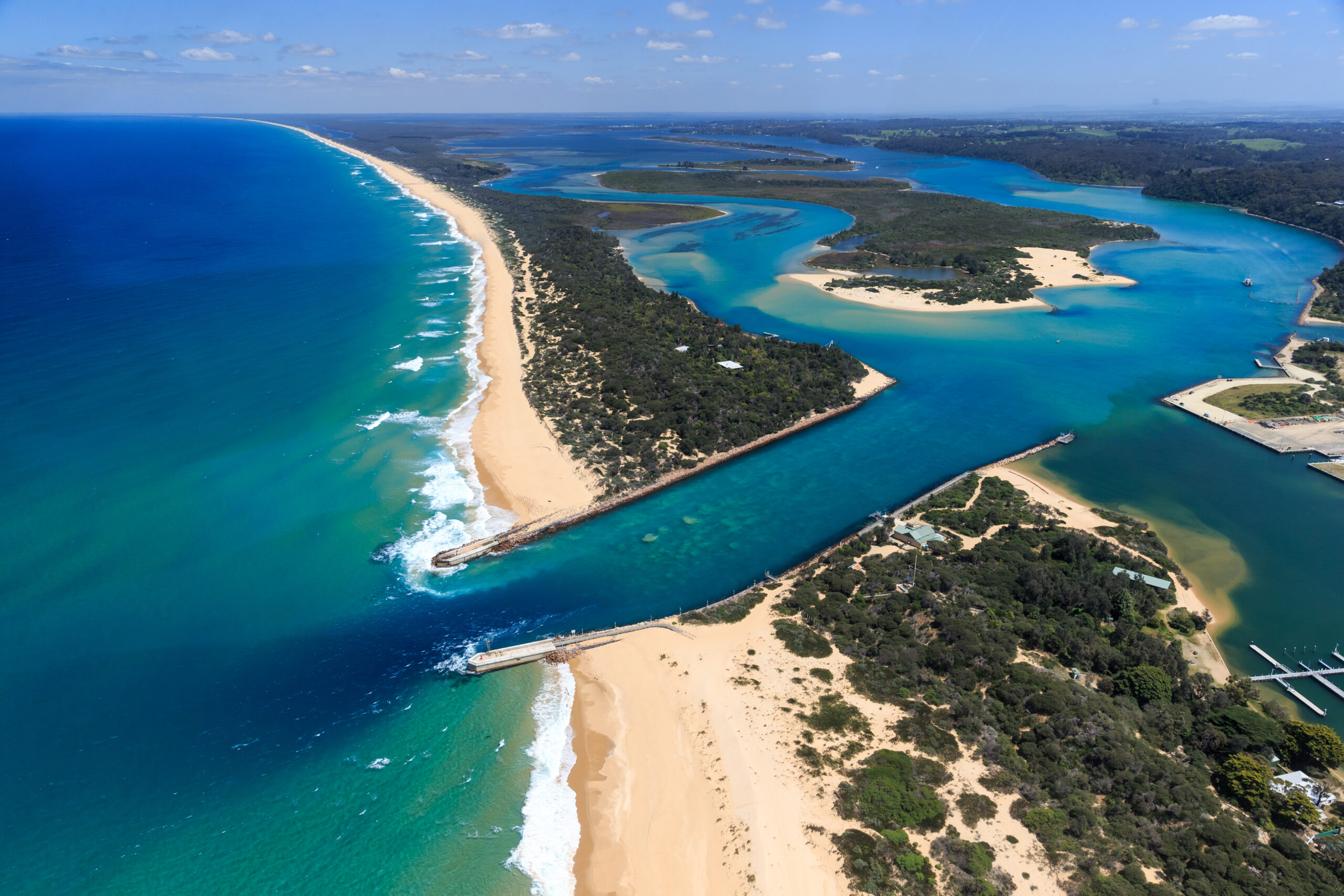
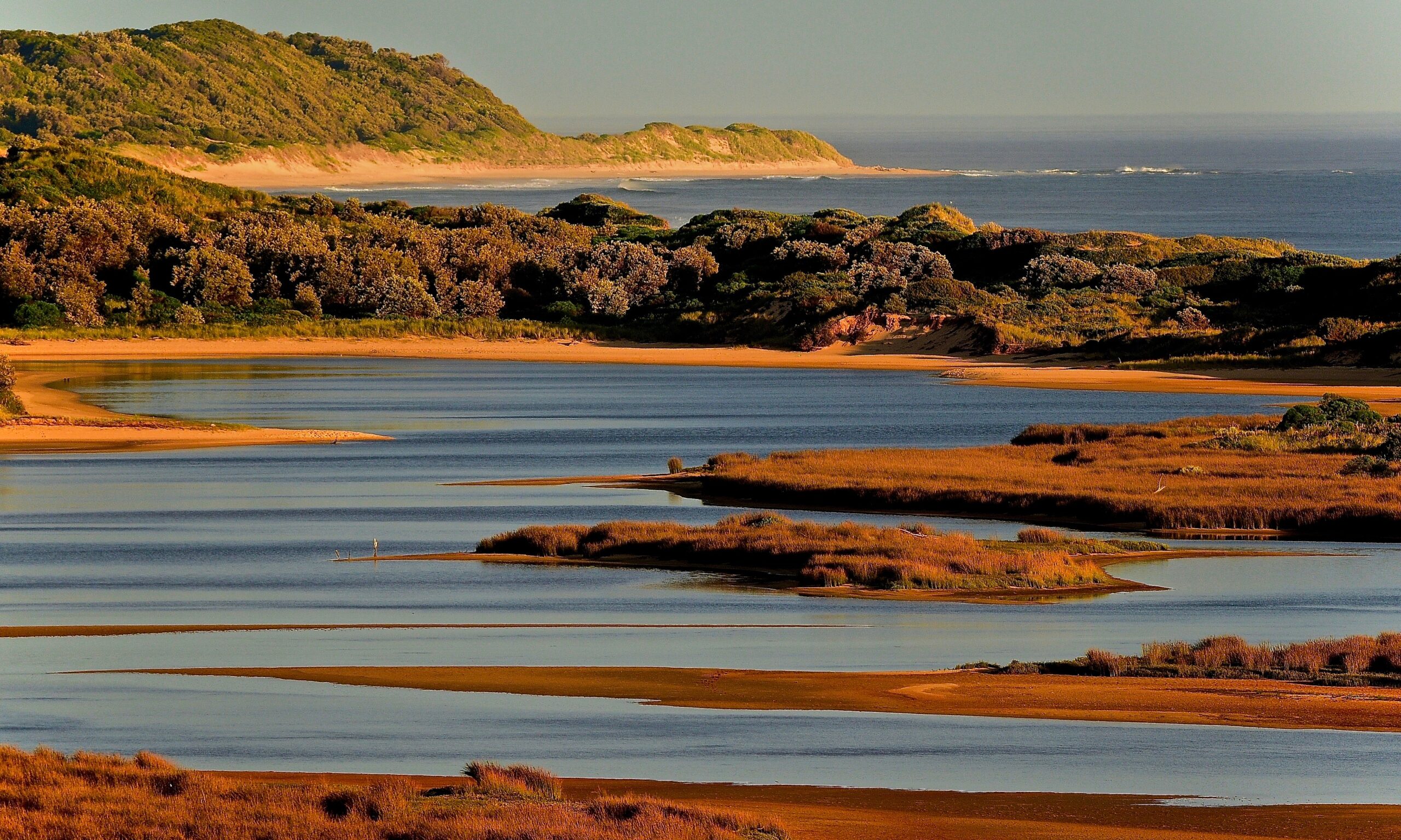
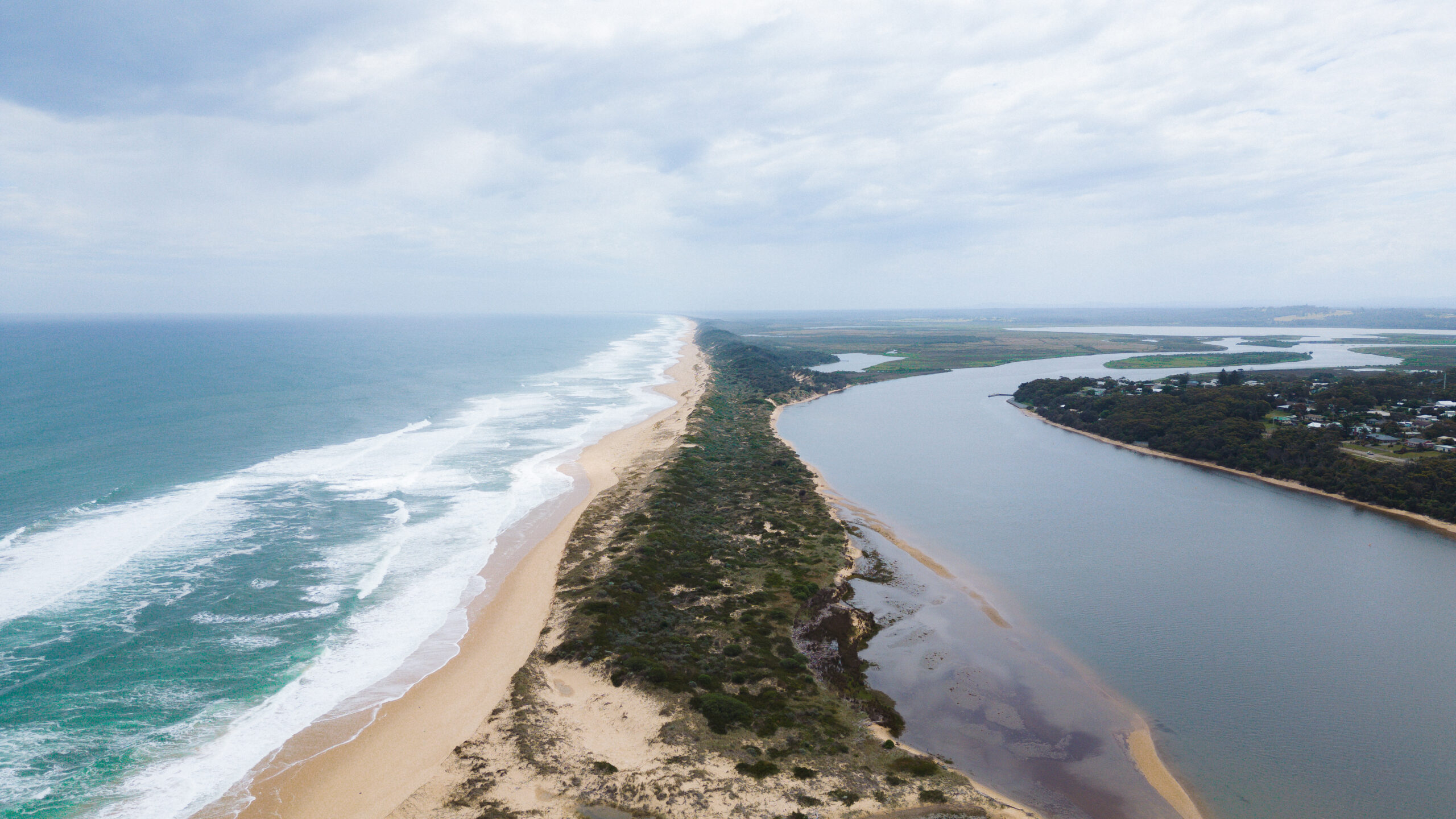
Mots Beach & Frenchs Narrows Coastal Walk
Grade 1. A short distance, 3km from Marlo.
At MOTS Beach, take the track down to the Snowy Estuary to view the Mouth of the Snowy River. Stroll along westerly along the foreshore to the jetty, in the Marlo township, or easterly towards Frenchs Narrows.
How to get there:
Just out of the township of Marlo heading towards Cape Conran, Mots beach carpark is located opposite the Marlo racecourse.
40 minutes
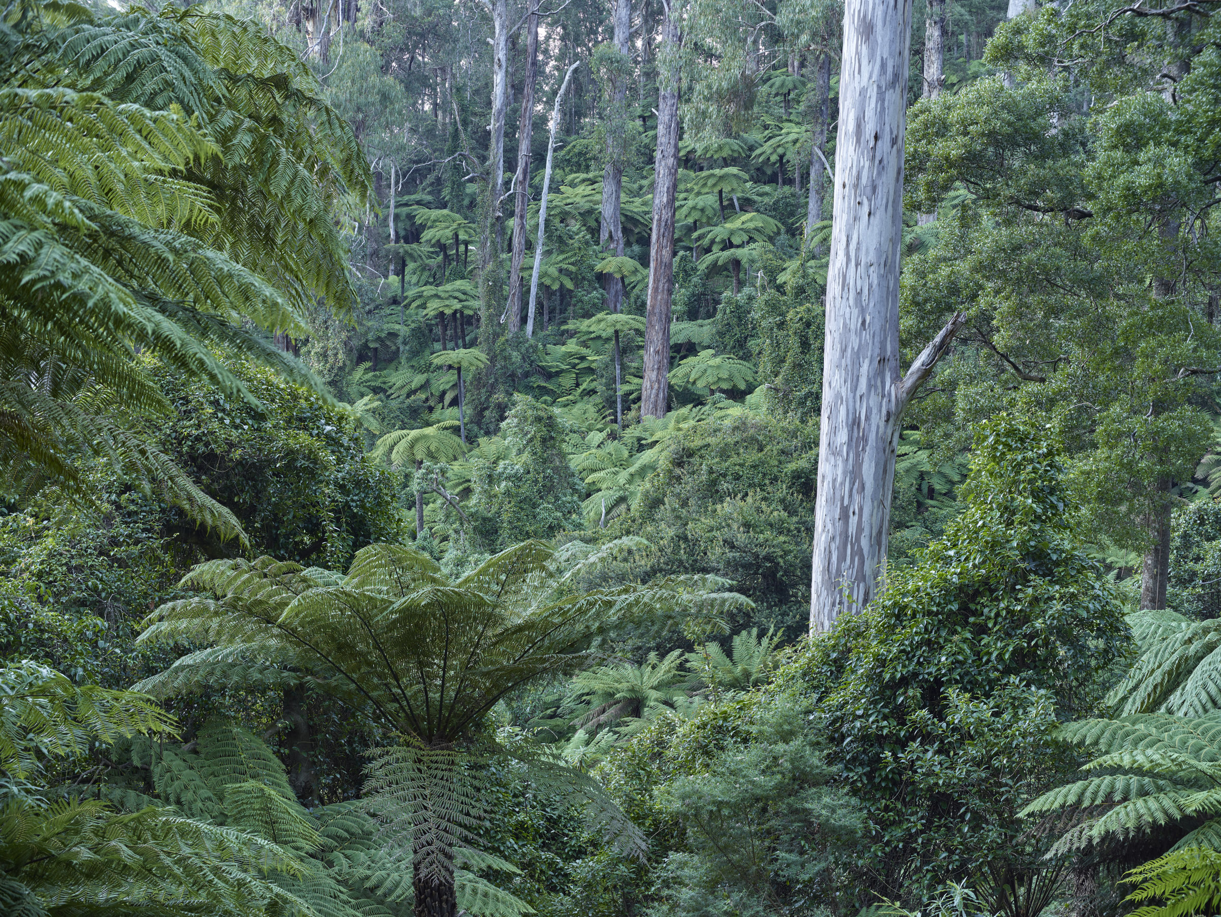
Errinundra Saddle Rainforest Walk
Errinundra National Park. Grade 2. 1km (40 minutes). Distance from Orbost 107km (2 hours).
Unique to East Gippsland, the ancient cool temperature rainforest of the Errinundra Plateau is dominated by southern sassafras and black olive berry, and features enormous mountain plum pines, some over 400 years old. As well as Victoria’s largest stand of rainforest, the plateau supports magnificent tall eucalypt forests of shining gum and cut-tail, and beautiful stands of silver wattle. Some of these forest giants are several hundreds of years old and occur over an understorey rainforest, creating what’s known as a ‘mixed forest’. The Errinundra Plateau is the source of seven rivers flowing south, north, and east, providing water for many communities before joining Bass Strait or the Snowy River.
Remnants of ancient Aboriginal trails and meeting places remain on the plateau, illustrating its cultural significance. There are also signs of European history, from derelict mine shafts and old fence lines to machinery left behind from early grazing leases, gold mining, and timber harvesting.
The walk starts from Errinundra Saddle, which features interpretive displays and information on the nature of the rainforest and the history of the park. It’s an easy self-guided trail under the rainforest canopy, crossing streams and passing elegant ferns and colourful fungi. Most of the track is on a boardwalk raised over the forest floor, designed to protect the delicate environment and provide visitor comfort. Drive to Mount Ellery and Ocean View Lookouts in the south of the park for spectacular views across the forested mountains and valleys to the distant coast.
How to get there:
There are two main options for reaching attractions in Errinundra National Park. The best route depends on vehicle type and weather conditions.
Option 1 – Errinundra Rd / Gunmark Rd / Gap Rd (Bendoc Rd) Loop
Not suitable for conventional 2WD vehicles.
In dry weather, may be accessed by SUVs with good ground clearance; otherwise, a 4WD is recommended.
Errinundra Road is seasonally closed.
Distance: 39km loop, allow 1.5 hours driving plus time for walks (total trip is 3+ hours).
Option 2 – Snowy Country Trail via Bonang Highway
The Bonang Hwy to Errinundra NP is windy in parts—drive carefully.
Road is unsealed and may not be suitable for 2WD vehicles during wet seasons.
Check road conditions if traveling during wet periods.
Preparation is essential for visiting:
Check road conditions ahead of your trip.
Limited conveniences are available, so stock up on supplies and fuel at Orbost and Bonang before departing.
Safety Tips
Bring all food, drinks, and fuel, as there are no shops or fuel stations along these Errinundra touring routes.
Mobile phone service is patchy; assume none is available.
Log trucks may use these roads: it’s recommended to monitor UHF channel 40.
Road conditions can deteriorate after heavy rain or snow.
During wet periods, roads are not suitable for 2WD vehicles or towing.
30 minutes
Orbost Slab Hut & Snowy River Walk
Grade 1. 30 minutes return (optional)
Step back in time at the Orbost Slab Hut Visitor Information Centre, a much-loved local icon and “living museum.” This original 1872 settler’s dwelling was relocated to its current spot in Forest Park in 1970 and now warmly welcomes travellers to Orbost. Inside, you’ll find friendly local staff ready to share expert advice, maps and brochures, and a charming range of local gifts, books, and keepsakes that help preserve this historic little building.
From the Slab Hut, enjoy an easy stroll along the banks of the Snowy River, a gentle track tracing the picturesque banks of the legendary Snowy. Take your time and wander either upstream or downstream through a beautifully landscaped rainforest setting alive with native flora and fauna. You’ll pass peaceful picnic spots, shady lawns, and interpretive signs that share stories of the town’s early settlers. The walk is perfect for a quiet moment by the water, a lazy riverside picnic, or an easy stroll into Orbost’s main street, Nicholson Street, for coffee and cake.
Nicholson Street stretches for four blocks from Forest Park and the Slab Hut Visitor Information Centre up to the roundabout at Salisbury Street, home to the grand old Commonwealth Hotel. Along the way, you’ll discover Orbost’s key retail and food outlets – from cosy cafés and bakeries to organic produce shops, Thai meals, pub dining, and two supermarkets. It’s also a heritage walk in itself, with informative signs revealing stories behind the historic shopfronts and landmarks that line the street.
Just two blocks off Nicholson Street lies the Sensory Gardens, a community-managed green space designed to engage all five senses through its curated plantings. The meandering pathway continues past the historic Butter Factory and leads back to Forest Park and the Riverside Path, linking into the Snowy River Walk and beyond to the East Gippsland Rail Trail.
Forest Park itself is a welcoming green space with playgrounds, barbecues, picnic areas, and public toilets – perfect for families, highway travellers, and anyone ready to stretch their legs under the shade of exotic hardwood and softwood trees. It’s both the gateway to Orbost and the starting point for some of its most scenic short walks.
Be prepared - Plan Ahead
For the best and safest experience on East Gippsland’s great outdoors and walking trails, always plan ahead and check for the latest safety advice before you set out. Visit the Parks Victoria website for essential safety tips, up-to-date park conditions, and changes or closures that may affect your journey. Before exploring, consider downloading the More to Explore app for offline park maps and alerts, and keep informed about local emergencies by accessing the East Gippsland Shire Council Emergency Dashboard and other helpful resources through our Plan your Visit & Travel Advice pages. Being prepared helps you get the most out of your adventure while staying safe and informed.
Eat Drink Gippsland
Enjoy a country lunch, dinner, or a bakery stop in the Snowy River Country—ideal for fueling up before tackling a trail or relaxing after a rewarding walk! For a great range of dining options and up-to-date information in Orbost, Marlo, and Buchan, please see our Eat & Drink page.
Marlo, Snowy River Country
Plan your visit
More to explore app
Plan your journey in advance. Download the free More to Explore app and access forest information wherever you go in Victoria.