discover more discover more discover more discover more discover more discover more
discover more discover more discover more discover more discover more discover more
The Cassilis area was the centre for extensive gold mining operations during the late 20th Century. The following walks touch on some of this remarkable history.
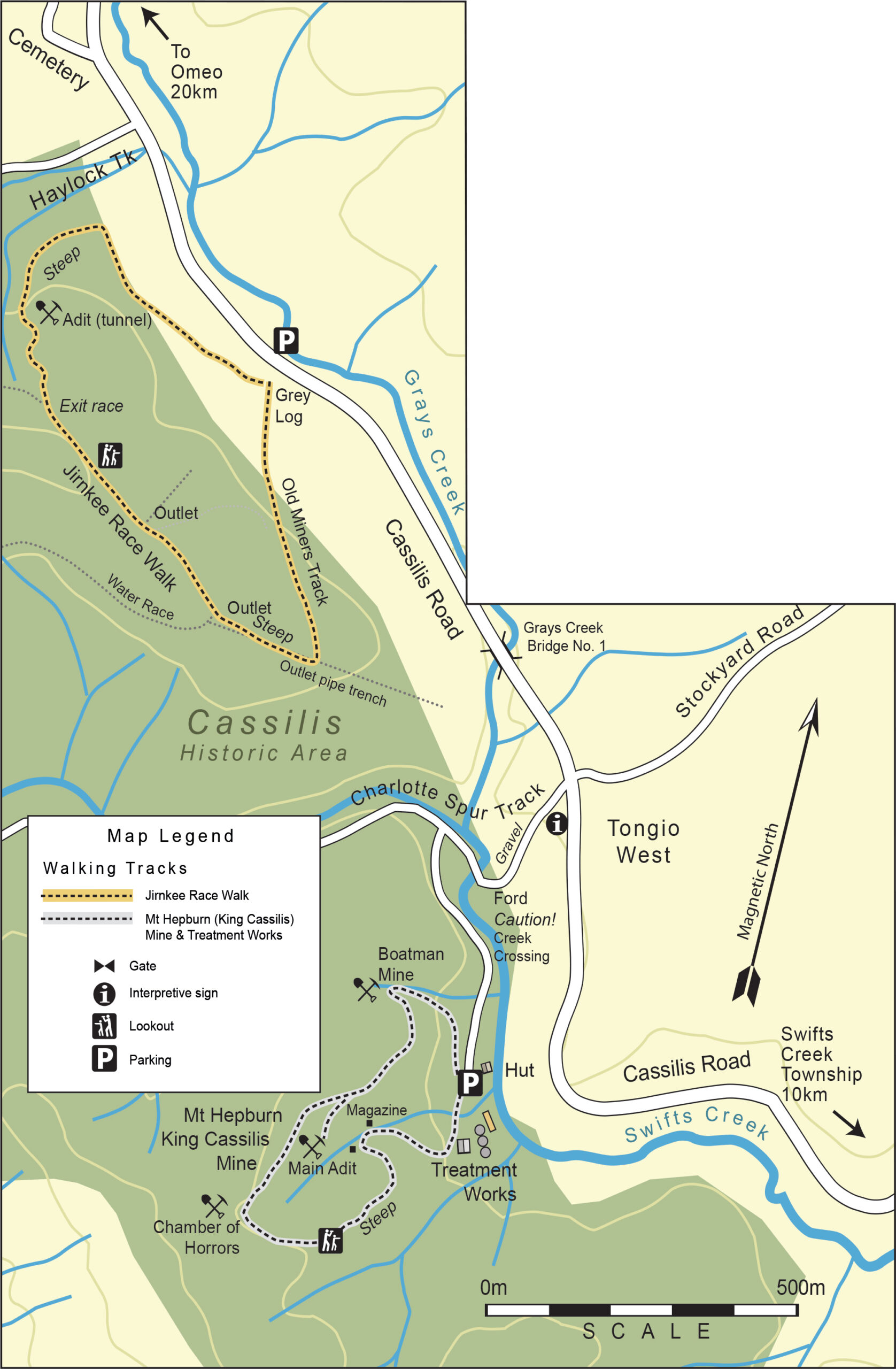
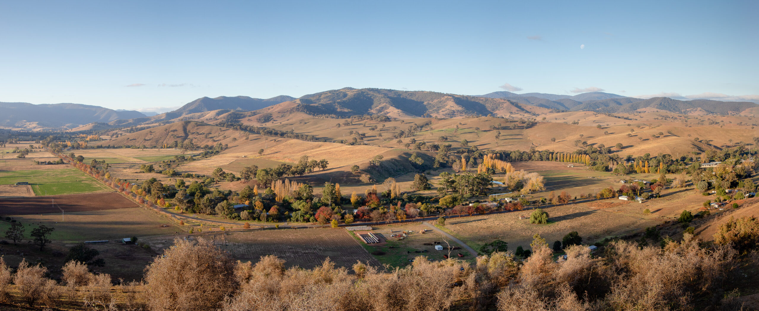
To get to Cassilis from Swifts Creek, travel north along Cassilis Road for about 10 km. Cassilis Road heads directly from the centre of Swifts Creek and winds through picturesque countryside, leading into the historic Cassilis gold mining area. Landmarks like the Jirnkee Race Walk can be found by following signage along Cassilis Road and watching for turn-offs such as Charlotte Spur Track. The area is accessible by standard vehicles, but be cautious of gravel sections and creek crossings (always check water levels before crossing).
1.5 hours
Jirnkee Race Walk
Grade 4. Very steep sections, unformed track, directional markers. 2 km (1.5 hours return)
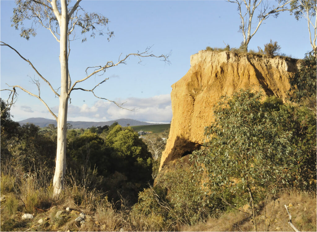
At 77 kms, the hand-dug Jirnkee Water Race at Tongio West near Cassilis, is the longest in the southern hemisphere and one of the great engineering feats of Victoria’s gold era.
It was built between 1899 and 1903 to provide water to the London-based Jirnkee Hydraulic Sluicing Company P/L for gold mining operations. Taking water from the head of the Wentworth River, over the Great Dividing Range and back to the southern side of the Divide at Cassilis Gap to where water was scarce. The project proved disastrous. The race failing to provide all-year round water, whilst construction costs exceeded the original estimate of £2000 to £14,000. Running costs also outstriped gold production. Overall the company suffered a nett loss in the order of £40,000 – millions in today’s currency – ceasing operations late in 1905 after just four years.
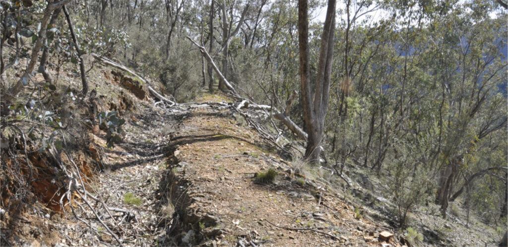
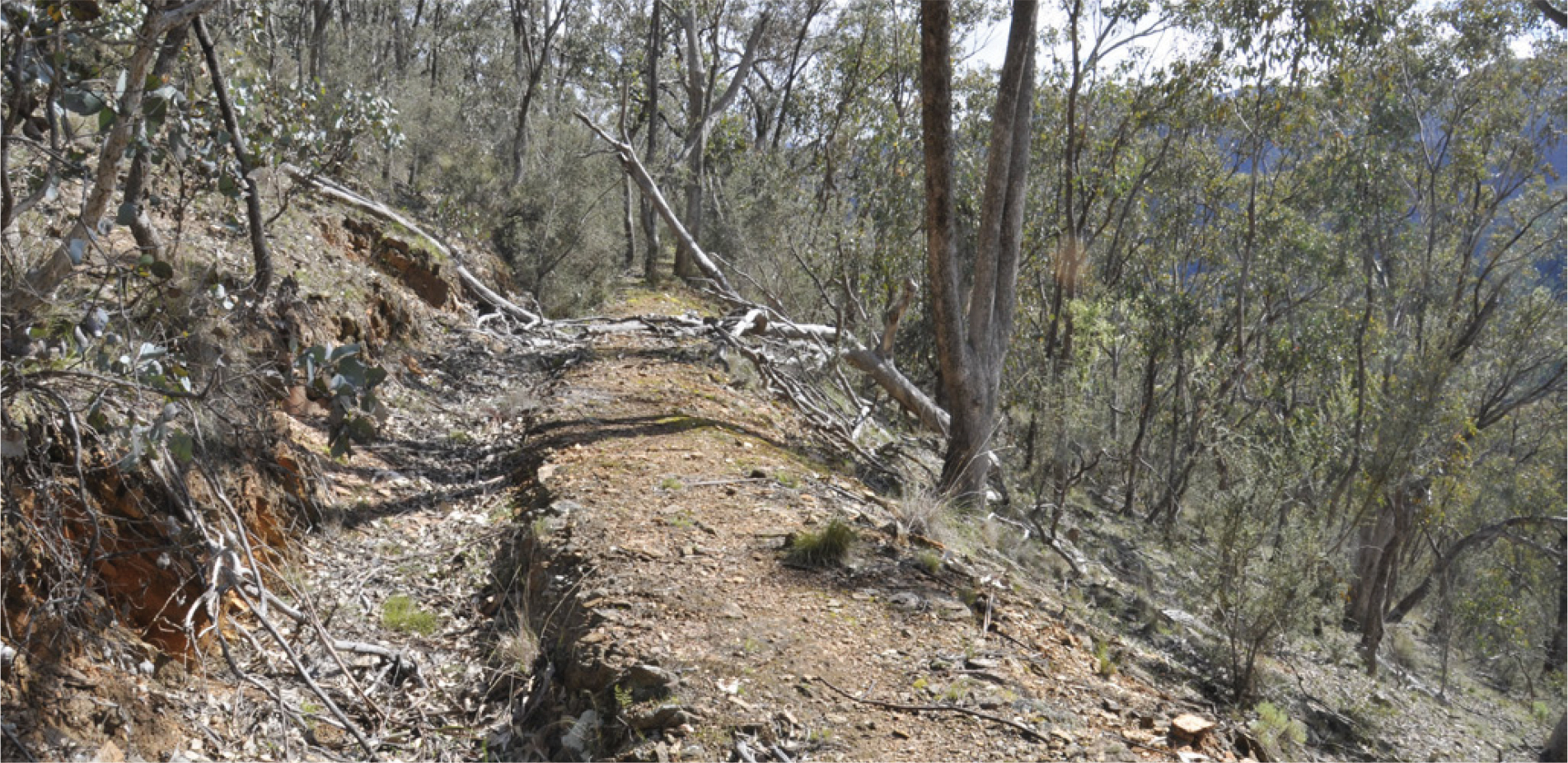
This 1.5 km walk of the final section of the historic Jirnkee Race begins 900m north-west of Charlotte Spur Track on the Cassilis Road. A large tree stump on the left side of the road (coming from Swifts Creek) marks the start of the walk. Look for the orange markers.
The track, flat at first, follows an old miners’ path which heads uphill towards the final section of the Jirnkee Water Race. It is well worth the steep climb through the Box eucalypt forest to see the trench where the race once gave way to a steel pipeline used for both water sluicing of the gravel beds below and for power generation, and up to the race termination point where gates once controlled water flow. From here the track is almost flat as it hugs the plateau where the race was dug into the rocky ground using hand tools.
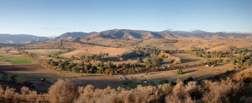
The views from the plateau to the surrounding ranges are spectacular in places. The track veers back downhill to the starting point after about 300 metres. Follow the markers to the bottom – beware, the descent is steep and the surface sometimes unstable.
Mt Hepburn (King Cassilis) Mine & Treatment Works
Grade 3. Steep sections. 2 km (1.5 hours return)
Gold-bearing quartz reefs were first opened up in the Mt Hepburn leases area in the late 1860s. However, difficulties in retrieving gold from complex ores saw many of the mines abandoned by the 1870s.
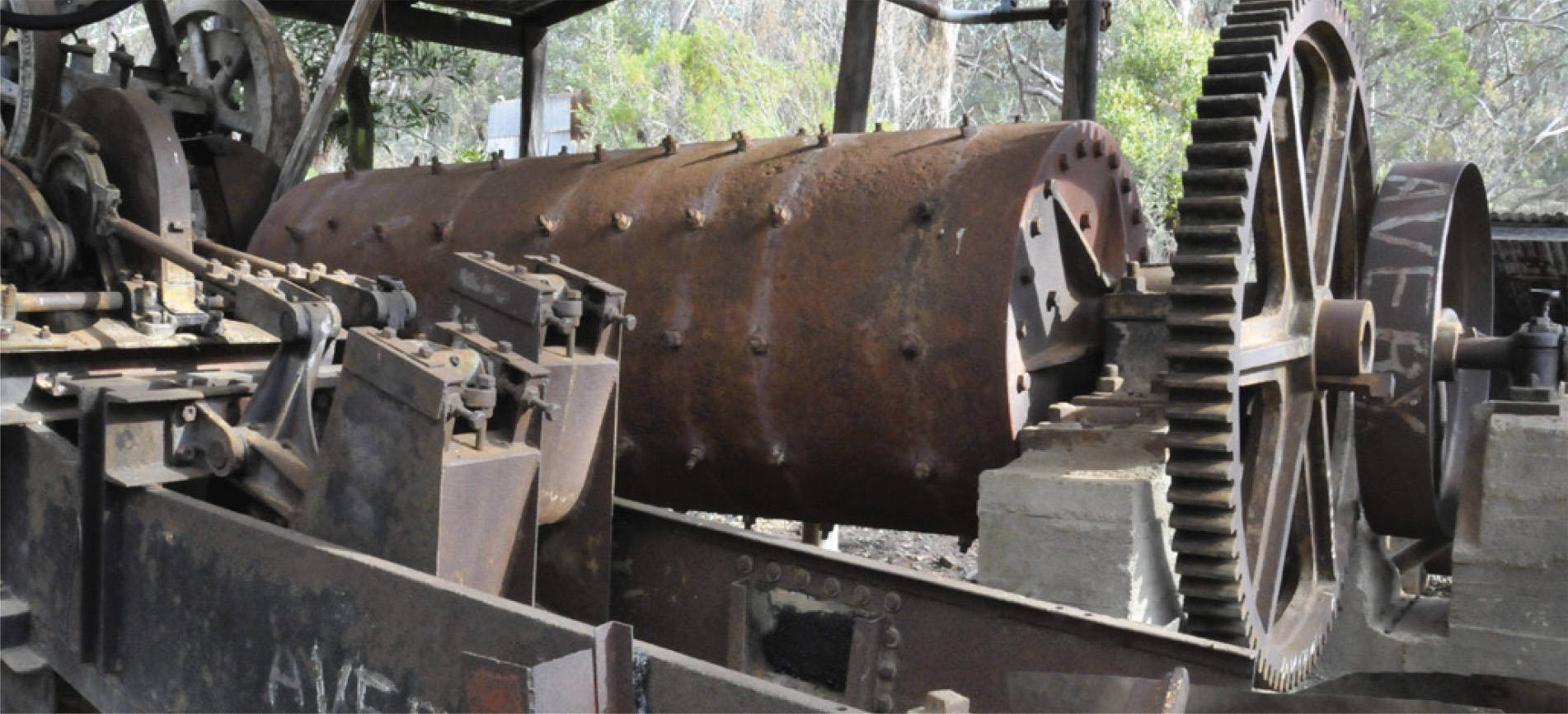
In 1888 the ground was leased and a mill erected a year later. In 1896 the English-based Mt Hepburn Co took over the leases and built a 20-head battery to crush the quartz. In 1897 a large cyanide processing plant was built. Despite its investment, poor gold returns, over-estimated ore reserves and poor metallurgy forced the company to cease operations with a loss to shareholders of some £180,000.
A large furnace to treat ores was built in 1900. It was one of the largest ore-roasting furnaces in Victoria at 15.2 m long and 3m high. Between 1900 and 1903 it is estimated to have treated 2,500 tons of concentrates for a yield of about 5000 ounces.
Over the years several attempts to rework the mine were undertaken with varying degrees of success. In the late 1940s a small blast furnace was built and smelted ore for many years.
To visit this historic gold mining area, drive 10kms from Swifts Creek or 20km from Omeo on the Cassilis Road. Turn on to the Charlotte Spur Track, crossing the Swifts Creek ford after 150m (low clearance vehicles should not cross – always check water levels before crossing). Turn left 30 metres past the ford on to an unmarked track and drive about 300m to a hut. Park and walk from here.
The walk to King Cassilis mine follows a 4WD track up the hill. After 200m pass a mullock heap and adit (horizontal tunnel) – site of a mine known as the Boatman. Continuing on a lower track leads to the main adit of the Mt Hepburn mine. Continue back up the hill and along the main track to the workings known as the Chamber of Horrors. This large cavity is where the gold-bearing stone was mined. Continue along the steeply descending track. At the bottom of this section see the fireplace remains in the gully above the track. A short distance along are the remains of an old explosives magazine store.
Continue through the treatment works to complete the loop.
1.5 hours
To make the most of your walks, be prepared!
The weather in this area can change quickly. Wear a hat and sturdy footwear, and make sure you carry water, sunscreen, insect repellent and a waterproof jacket. Be aware that venomous snakes are a natural part of the Australian environment and are active during warmer months. Never attempt to pick them up – quietly wait for them to pass.
related itineraries related itineraries related itineraries related itineraries related itineraries related itineraries related itineraries related itineraries related itineraries related itineraries related itineraries
Websites store cookies to enhance functionality and personalise your experience. You can manage your preferences, but blocking some cookies may impact site performance and services.
Essential cookies enable basic functions and are necessary for the proper function of the website.
Name
Description
Duration
Cookie Preferences
This cookie is used to store the user's cookie consent preferences.